
DOES C4Gnet.XYZ HAVE AN AUTOMATED POST-PROCESSING SERVICE?
Yes, we offer the C4Gnet.XYZ GNSS Online Post Processing Service that uses data from all of our CORS (which includes some NGS CORS). This is similar to the NGS OPUS service which only works (presently) with the GPS constellation whereas our Online Post Processing Service supports satellites from GPS, GLN, GAL, and BDS constellations.
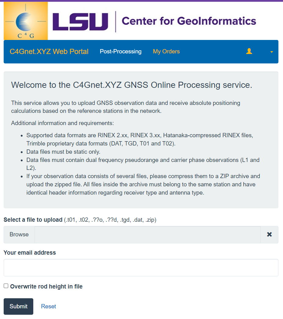
The C4Gnet.XYZ GNSS Online Post Processing Service provides users with an option to post-process (e.g., when they work out of cell range, or wish to check control values) in an automated service that constrains to our stations, as well as the NGS CORS, resulting in positions aligned to the National Spatial Reference System (NSRS). Registered users can log in to C4Gnet.XYZ, choose Online Post Processing on the upper left of the page, submit static files, and our system will do the baseline processing. Supported data formats are RINEX 2.xx, RINEX 3.xx, Hatanaka-compressed RINEX files, and Trimble proprietary data formats (DAT, TGD, T01 and T02). Simply upload your static GNSS data, enter your email address and choose to overwrite the rod height or not, and hit the submit button.
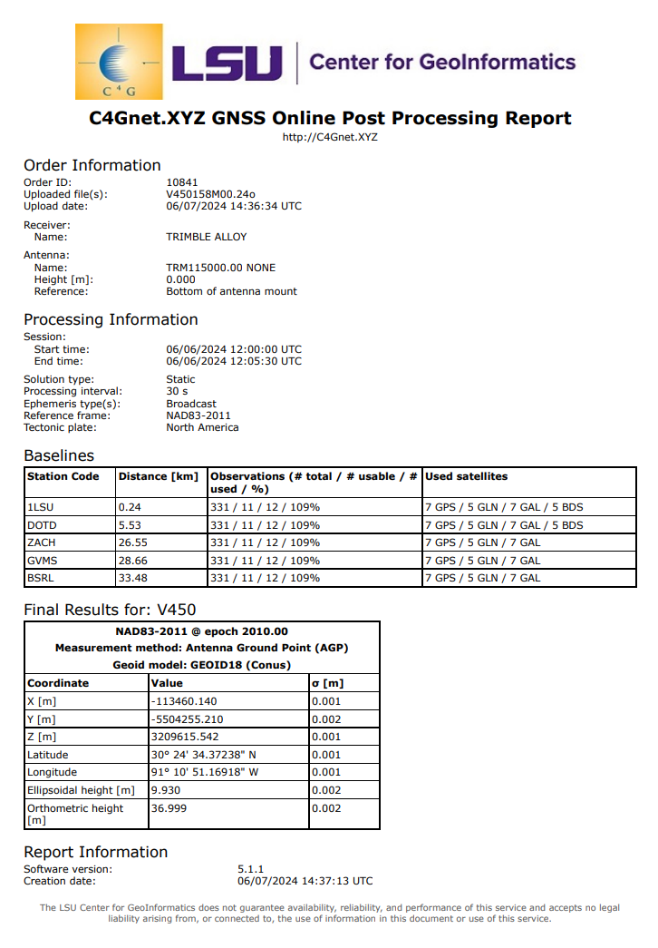
The C4Gnet.XYZ GNSS Online Post Processing Service will email a PDF of the results once it finishes processing, or you can download a copy of the report in PDF and/or an XML file format directly from the C4Gnet.XYZ web portal. The results are in NAD83-2011 coordinates (not state plane; you will need to convert that yourself) and include both ellipsoidal and orthometric heights. C4G provides free subscriptions to this service to anyone who contacts us and requests access. Using this tool can be a good supplement to validate or check control values on various field operations.
Example Report:
No questions yet.