Note that the LSU Center for GeoInformatics is actively pursuing the funding necessary to do the control work needed to create better GEOID models in Louisiana. Feeding well distributed vertical control data into future GEOID models will improve the vertical accuracy of these models and is perhaps our only hope of ever creating a ±1cm GEOID in the state of Louisiana. |
||
|---|---|---|
|
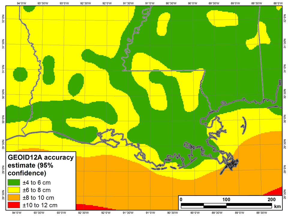
The NGS presentation on Friday March 15, 2013, pointed out that GEOID12a produces 95% confidence at ± 4 to 8 cm in Louisiana. The NGS conclusion states that the problem is too large for NGS to handle alone and we all need to work together to get better height results. They also recommend partnering with locals to leverage existing resources and that a plan needed to be created to move forward with improving heights. |
|
|
|
The presentation was given by NGS geodesists / scientists, Michael Dennis and Dan Roman.
|
||
|
Big picture ideas to consider from the presentation
|
||
|
Recently, NOAA’s National Geodetic Survey released updated orthometric heights for Southern Louisiana relative to the September 2010 GNSS Height Modernization project. These heights represent the most up to date heights available for the region. On March 15, 2013, NGS hosted a free, on-line webinar to present the results of this project. |
|
Visit the NGS page for this event To download the .mp4 file, click here. Link to the presentation: |

 NGS plot shows GEOID12a produces 95% confidence at ± 4 to 8 cm in Louisiana