LSU Center for GeoInformatics & Louisiana Spatial Reference Center
Providing Value to Louisiana & the Nation - 2001 - 2026

Our Story
The Louisiana Spatial Reference Center (LSRC) provides Louisiana’s official geodetic framework through its GULFnet CORS network, and the Center for GeoInformatics (C4G) provides the C4Gnet Real-Time Network. These systems deliver precise positioning for surveying, mapping, and research, supporting public safety and infrastructure planning. LSRC collaborates with NOAA and NGS to maintain alignment with the National Spatial Reference System and leads modernization efforts that integrate GNSS, InSAR, gravimetry, and astrogeodetic technologies. Sustaining this capability requires diversified funding and partnerships to address critical geospatial challenges.
Greetings From the Director
 As Director of the LSU Center for GeoInformatics (C4G), it is a privilege to reflect on twenty-five years of progress, service, and partnership through the Louisiana Spatial Reference Center (LSRC). When C4G was founded in 2001, Louisiana faced a critical geodetic challenge. NOAA had just informed Congress that our state’s vertical control system was unreliable due to widespread land movement, historic survey limitations, and the accelerating impacts of sea-level rise. This posed significant risks to infrastructure, communities, and industries that depend on accurate elevations.
Under the visionary leadership of our founding Executive Director, Professor Roy K. Dokka, C4G responded with purpose. Working closely with NOAA’s National Geodetic Survey, we established the Louisiana Spatial Reference Center. We initiated GULFnet —a modern GNSS-based positioning network designed to replace fragile benchmarks with a dynamic, continuously monitored reference frame. Over the years, GULFnet has grown into one of the most advanced and trusted CORS networks in the country, integrating Louisiana into the National Spatial Reference System and serving as the foundation for precise positioning.
Building upon LSRC’s mission, C4G launched the C4Gnet Real-Time Network in 2007, ensuring that high-accuracy positioning could be delivered directly to surveyors, engineers, and researchers in the field. Today, these networks support a wide range of applications, including coastal restoration and flood protection, transportation design, subsidence monitoring, emergency response, and scientific discovery. Legislative actions, including Acts 194 (2006) and 626 (2024), have formally recognized LSRC’s role as Louisiana’s geodetic authority and affirmed the value of this work for the public good.
Our evolution has been shaped not only by technological change but also by the dedication of the LSRC/C4G team and the trust of our stakeholders. We have continued to advance the state’s geodetic framework, expanding collaborations with NOAA, NASA, NSF, USACE, LADOTD, and numerous professional and academic partners. We have modernized instrumentation, grown our user community, and contributed to research that deepens our understanding of subsidence, a challenge central to Louisiana’s present and future.
As we celebrate this Silver Anniversary, our commitment remains clear: to maintain a resilient, science-driven spatial reference system; to support Louisiana’s infrastructure and natural resources; and to uphold the public mission of LSU through research, outreach, and service. The next twenty-five years will bring new technologies and new demands for precision. With continued support and collaboration, LSRC and C4G stand ready to meet them.
Executive Summary
The Louisiana Spatial Reference Center (LSRC) has spent over two decades building the Louisiana Spatial Reference System, through its backbone, the GULFnet network. Along with the C4Gnet Real-Time Network (RTN), they provide a robust framework for precise geodetic and geospatial positioning across Louisiana.
As part of Louisiana State University (LSU), LSRC serves as a critical link between scientific research and the geospatial community. Based in LSU’s Engineering Research and Development Building (ERAD), we support professional users and academic partners through outreach, education, and technical expertise.
C4G operates the Louisiana Real-Time Network, C4Gnet, built on LSRC’s GULFnet—a statewide network of Continuously Operating Reference Stations (CORS) established initially to study subsidence, tectonic activity, and aid in disaster mitigation. Today, C4Gnet serves a wide range of users who require accurate, real-time positioning.
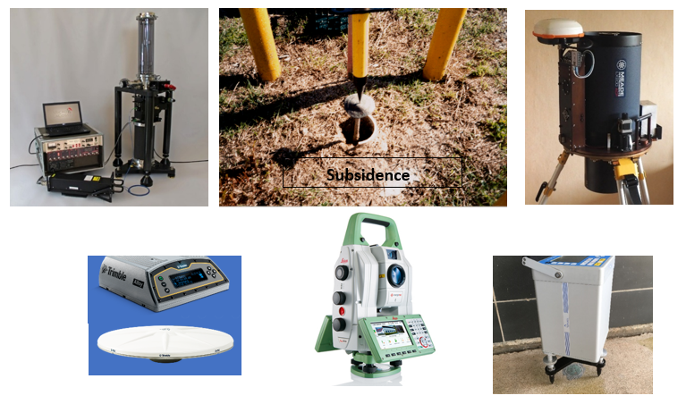
LSRC is committed to continuous modernization and expansion, including participation in NGS programs such as GPSonBM, the installation of reference monuments tied to GULFnet CORS, and the integration of advanced technologies, such as GNSS, InSAR, NISAR, absolute gravimetry, and astrogeodetic observations. These efforts enhance our ability to monitor ground deformation, sea-level change, and subsidence, both natural and anthropogenic causes, such as resource extraction.
LSRC’s expertise in bridging academic research and practical applications delivers significant value to public safety and infrastructure planning. Meeting our objectives requires diversified funding and partnerships to close geospatial knowledge gaps and address critical challenges.
Purpose and Vision
The Louisiana Spatial Reference Center (LSRC) is responsible for establishing, maintaining, and delivering the Louisiana Spatial Reference System (LSRS), which defines the geodetic datum for precise positioning across the state. At its core is GULFnet, a modern network of geodetic-quality Global Navigation Satellite System (GNSS) Continuously Operating Reference Stations (CORS) strategically located throughout Louisiana and adjacent areas. This network, supported by advanced geophysical models and digital infrastructure, provides a reliable spatial reference framework through LSU’s Center for GeoInformatics (C4G) servers and databases. GULFnet is fully aligned with the National Spatial Reference System (NSRS) and NOAA’s National Geodetic Survey (NGS) standards.
Maintaining LSRS requires continuous monitoring and adjustment of GULFnet coordinates to account for subsidence, tectonic movement, extreme weather events and human activities. LSRC ensures the rapid restoration of geodetic control in affected areas by publishing updated coordinates and distributing them via the Louisiana Real-Time Network (C4Gnet).
Our services support a wide range of users, including land surveyors, GIS professionals, researchers, government agencies, and navigation specialists. To remain effective, LSRC must prioritize modernization and expansion, integrating emerging technologies and enhancing its capabilities to meet the growing demands for geospatial solutions.
Education, outreach, and advocacy are central to these efforts. Sustaining operations requires sustained, independent funding, as reliance on short-term grants and donations is not a viable option—subscriptions to C4Gnet remain a critical component of financial stability.

Our Team
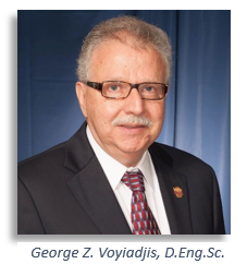
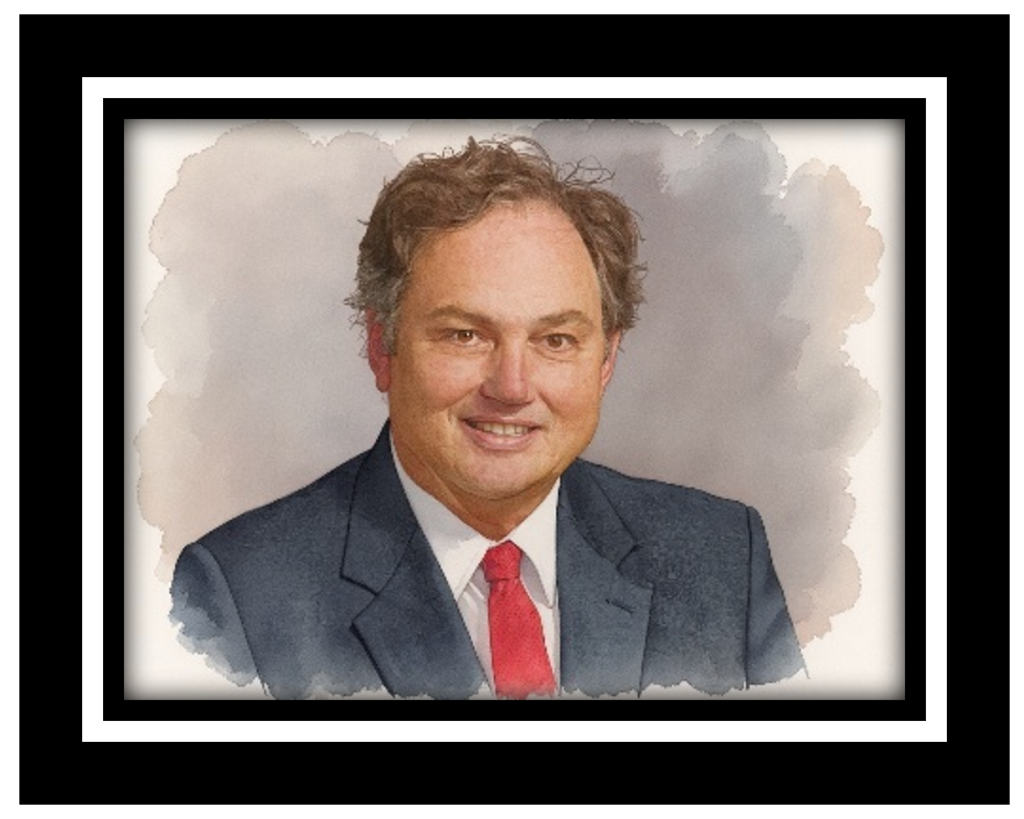
George Z. Voyiadjis - Director, LSU Center for GeoInformatics (C4G), and
Chairman of the LSU Department of Civil and Environmental Engineering
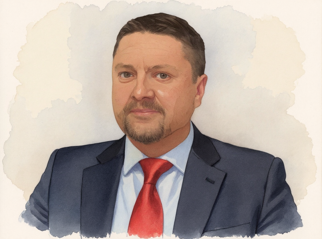
 George Zino Voyiadjis is the Boyd Professor at Louisiana State University in the Department of Civil and Environmental Engineering. This is the highest professorial rank awarded by the Louisiana State University System. He is also the holder of the Freeport-MacMoRan Endowed Chair in Engineering. He joined the faculty of Louisiana State University in 1980. He is currently the Chair of the Department of Civil and Environmental Engineering. He has held this position since February 2001. He also served as the Acting Associate Dean of the Graduate School from 1992 to 1994. He has also served since 2012 as the Director of the Louisiana State University Center for GeoInformatics (LSU C4G).
Elected to the European Academy of Sciences and Arts, 2021; Elected to the Academia Europaea Physics & Engineering Sciences, 2020; Elected to the European Academy of Sciences, 2019; Elected to the Korean Academy of Science and Engineering, 2016; Elected to the Polish Academy of Sciences, 2013; He is the recipient of the 2008 Nathan M. Newmark Medal of the American Society of Civil Engineers ASCE-EMI&SEI and the 2012 Khan International Medal for outstanding life-long Contribution to the field of Plasticity. He was also the recipient of the ICDM2 Lifetime Achievement Medal for his significant contribution to Continuum Damage Mechanics, presented to him during the Second International Conference on Damage Mechanics (ICDM2), Troyes, France, July 8-11, 2015. This is sponsored by the International Journal of Damage Mechanics and is held every three years. In 2022, he received the American Society of Mechanical Engineers (ASME) Nadai Medal from the Materials Division. He received the 2023 Blaise Pascal Medal for Engineering from the European Academy of Sciences. He recently received the American Society of Civil Engineers’ Engineering Mechanics Institute's 2024 Theodore von Kármán Medal. This Medal, in particular, is widely considered one of the highest honors in all areas of engineering mechanics.
Voyiadjis was honored in April of 2012 by the International Symposium on “Modeling Material Behavior at Multiple Scales” sponsored by Hanyang University, Seoul, Korea, chaired by T. Park and X. Chen (with a dedicated special issue in the Journal of Engineering Materials and Technology of the ASME). He was also honored by an International Mini-Symposium on “Multiscale and Mechanism-Oriented Models: Computations and Experiments” sponsored by the International Symposium on Plasticity and Its Current Applications, chaired by V. Tomar and X. Chen, in January 2013.
He is a Distinguished Member of the American Society of Civil Engineers, Fellow of the American Society of Mechanical Engineers, the Society of Engineering Science, the American Academy of Mechanics, the Engineering Mechanics Institute of ASCE, and Associate Fellow of the American Institute of Aeronautics and Astronautics. He was recently elected as a Senior Member of the National Academy of Inventors.
He holds three patents, has authored over 400 refereed journal articles, and has written 26 books (including 13 as editor). He gave over 430 presentations, including plenary, keynote, and invited talks. He lectured worldwide in Europe, North America, the Middle East, and Asia. Seventy graduate students (42 Ph. D.) completed their degrees under his direction. He has also supervised numerous postdoctoral associates. Voyiadjis has been highly successful in securing more than $40.0 million in research funds as a principal investigator/investigator from the National Science Foundation, the Department of Defense, the Air Force Office of Scientific Research, the Louisiana Department of Transportation and Development, the Federal Highway Administration, the National Oceanic and Atmospheric Administration (NOAA), and major companies such as IBM and Martin Marietta.
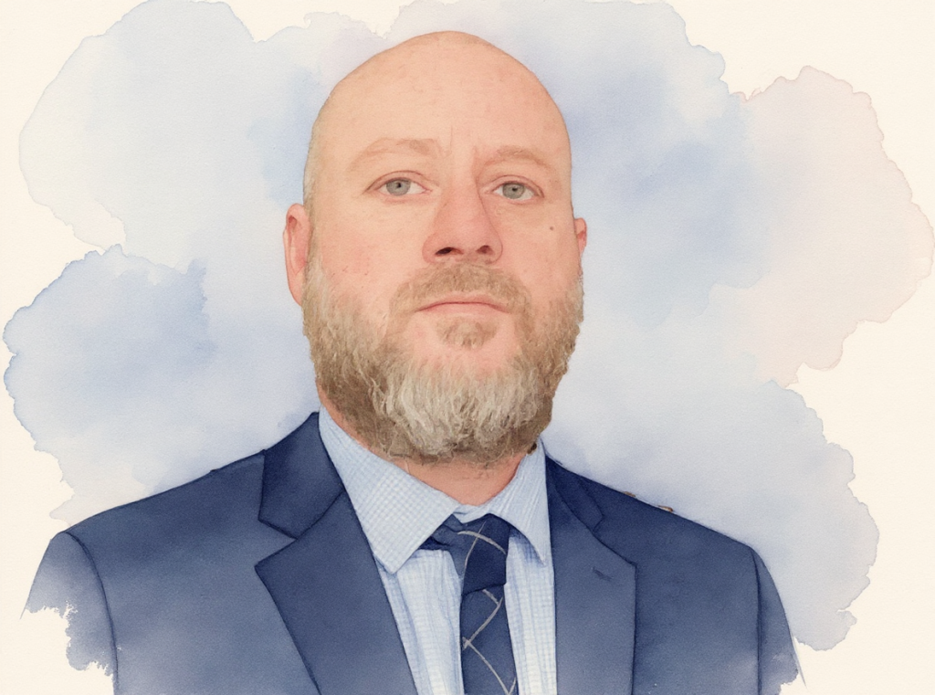
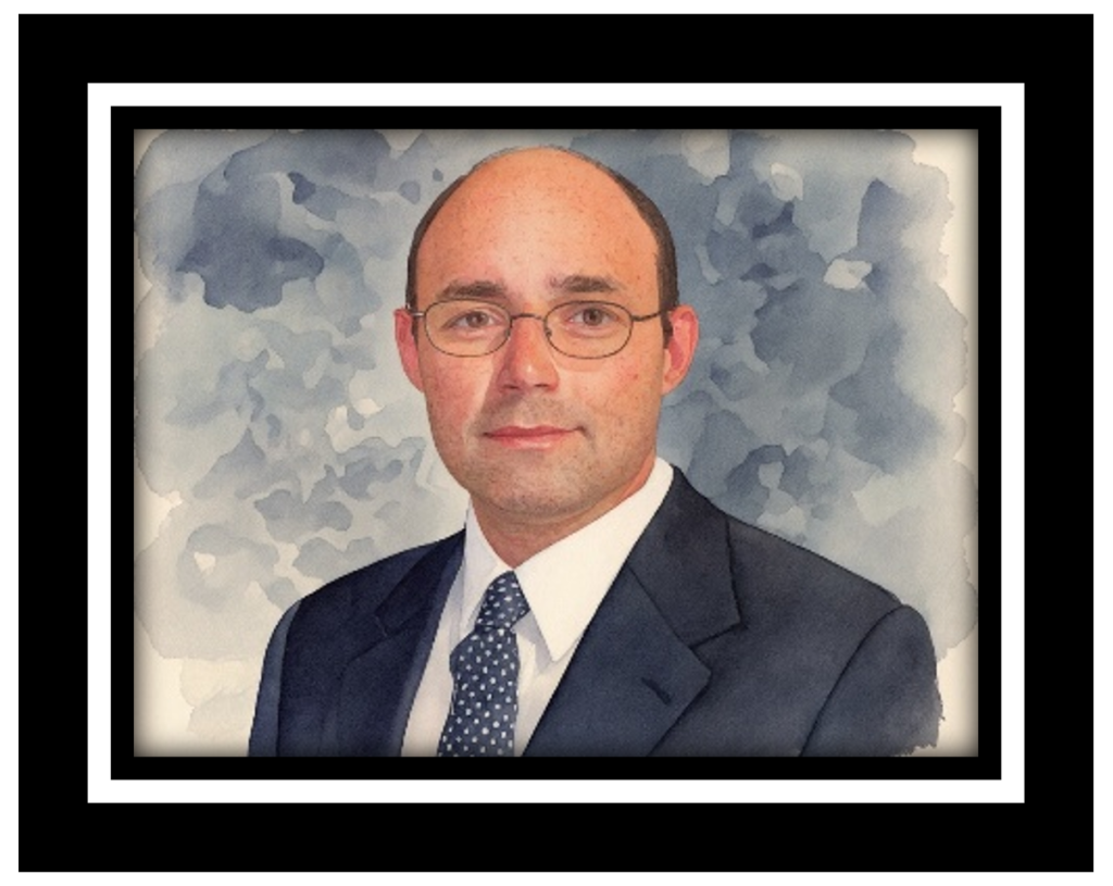
Ahmed Abdalla, Ph.D. - Assistant Professor Geodetic Research
Throughout his career, Ahmed Abdalla has lived and worked in various locations, enriching his academic and professional experience. Dr. Abdalla was born and raised in Sudan, where he initially developed an interest in Geodesy and geospatial sciences. He pursued his MSc in Geodesy and Geoinformatics at the Royal Institute of Technology (KTH) in Sweden, gaining a substantial foundation in geospatial systems. He completed his PhD while working as a research fellow at the University of Otago in New Zealand, focusing on surveying and geospatial applications. Currently residing in Baton Rouge, Louisiana, Dr. Abdalla serves as an Assistant Professor in the LSU Department of Civil and Environmental Engineering, contributing to research and education in. These diverse locations reflect his journey through various educational and research environments, broadening his understanding of international perspectives in Geodesy and Geoinformatics.
He participated in multiple research projects related to GPS and geospatial data analysis, enhancing practical applications using advanced technologies and can engage with industry partners to explore real-world applications of Geoinformatics, providing insights into how theoretical knowledge translates into practice. These earlier experiences laid a strong foundation for Dr. Abdalla's current work, enabling him to connect research and education effectively within the field of Geodesy and Geoinformatics. Through his various roles, he developed skills that are now instrumental in his teaching and research at LSU.
2023 Assistant Professor, Research, Center for GeoInformatics, Louisiana State University
2018 – 2024: Land Subsidence Research in Louisiana with Zhou and Voyiadjis, a framework that unifies GNSS and InSAR observations with hydro-mechanical, elasto-plastic-damage, and fault-activation models.
2018 – 2023: Assistant Professor, Research, Center for GeoInformatics, Louisiana State University
2017 – 2018: Visiting Scientist at Institute of Geodesy, Leibniz University of Hanover, Germany
2016 – 2017: Coordinator of Geomatics Engineering Master Programme, University of Khartoum
2015 – 2016: Lecturer at Faculty of Engineering Sciences, Omdurman Islamic University, Sudan
2014 – 2018: Assistant Professor, Department of Surveying Engineering, University of Khartoum
2014 – 2015: Research Engineer, Octantis Advanced Co., Ltd, Sudan
2014 – 2015: Quantity surveyor at John Fillmore Contractors, Auckland, New Zealand
2013 Ph.D. in Surveying, University of Otago, New Zealand.
2013 – 2014: Teaching Assistant at Unitec Institute of Technology, Auckland, New Zealand, Graduate Research Bursary from the School of Surveying, University of Otago, New Zealand
2009 – 2012: Teaching and Research Assistant at the University of Otago, New Zealand
2009 M.Sc. in Geodesy and Geoinformatics, Royal Institute of Technology, Sweden.
2003 B.Sc. in Surveying Engineering, University of Khartoum, Sudan.
2003 – 2008: Land Surveyor, Elnoui'us Petroleum Services, Sudan
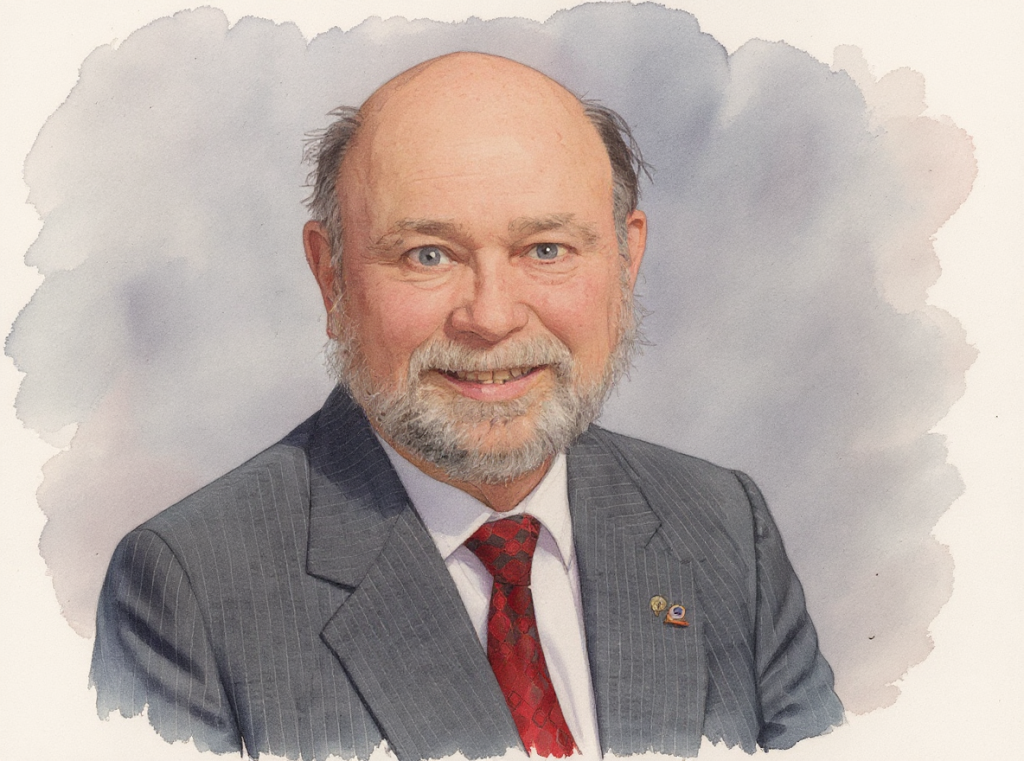
Clifford J. Mugnier, C.P., C.M.S. – Chief of Geodesy
Clifford J. Mugnier is an internationally recognized expert in Geodesy and Photogrammetry. His career began with the U.S. Army Corps of Engineers, where he contributed to research on lunar and terrestrial topographic mapping using satellite technology. He has extensive experience in geodetic surveying, topographic engineering, map projections, grid systems, boundary law, analytical photogrammetry, and geodetic astronomy.
Mr. Mugnier has designed, supervised, and executed geodetic surveys worldwide and is frequently consulted on network design, adjustment theory, software systems, and global grid systems/datums. His photogrammetric expertise spans stellar and plumb line camera calibration, instrument design, analytical triangulation, and applications in aerial, close-range, medical, and forensic photogrammetry. He has also developed and modified advanced photogrammetric and geodetic instruments, including a First-Order phototheodolite.
His technical background includes error propagation, matrix algebra, statistical analysis, projective geometry, and ellipsoidal conformal mapping. Mr. Mugnier is a Fellow of the American Society for Photogrammetry and Remote Sensing (ASPRS) and an Honorary Life Member of the Louisiana Society of Professional Surveyors (LSPS).
The CORS Active Control Monument, “CLIF” in Lutcher, Louisiana, has been established to honor the contributions of Mr. Mugnier at C4G.
2023 Authored: Coordinate Systems of the World/Datums and Grids, published by CRC Press.
1970 Advanced Photogrammetry (George Washington University).
1968 Applied Analytical Photogrammetry (US Army TOPOCOM).
1967 Professional Cartography (USAF A.C.I.C.).
1967 B.A. (Phys. Geography & Math (Northwestern State University).
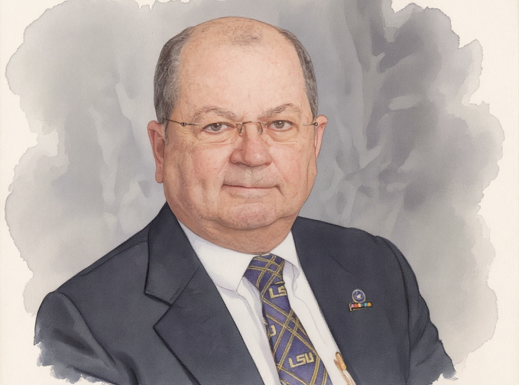
J. Anthony Cavell, PLS, CFedS – State Geodetic Coordinator, SRC
Tony Cavell is a licensed Professional Land Surveyor and Certified Federal Surveyor with decades of experience in Geodesy, surveying, and geospatial technologies. Born in Lafayette, Louisiana, he has lived and worked across the Gulf Coast and currently resides in Baton Rouge. His career spans leadership roles in private industry and academia, with a strong focus on advancing geodetic infrastructure and professional education.
Cavell began his professional career in physics at Louisiana State University before transitioning to surveying in the early 1980s. He served as Survey Manager for Sam Z. Scandaliato, Inc., and later as Offshore Survey Party Chief with John E. Chance and Associates, where he witnessed the evolution of positioning technologies from optical instruments to GPS. He held senior positions at Cochrane Subsea International. At Navigation Electronics, Inc. (NEI), as Vice President and later CEO, he helped transform the company into a nationally recognized provider of GIS and surveying solutions.
In 2005, Cavell joined LSU’s Center for GeoInformatics (C4G) and the Louisiana Spatial Reference Center (LSRC) as Associate Director, playing a key role in establishing GULFnet—a statewide GNSS CORS network and its real-time service, C4Gnet. After a period in private consulting, he returned in 2013. As State Geodetic Coordinator, he continues to lead initiatives in geodetic modernization, disaster response, and outreach.
A respected educator and speaker, Cavell has taught courses for federal and state agencies, professional societies, and academic institutions. He has served in leadership roles with the National Society of Professional Surveyors (NSPS), the American Association for Geodetic Surveying (AAGS), and the Louisiana Society of Professional Surveyors (LSPS). His contributions include numerous technical reports, conference papers, and articles on Geodesy, subsidence monitoring, and GPS standards. He has consulted or testified as an expert at trial or by deposition.
The CORS Active Control Monument, “TONY” in Lafayette, Louisiana, has been established to honor the contributions of Mr. Cavell at C4G.
2020 Associate Editor, Surveying and Land Information Journal (American Association for Geodetic Surveying)
2022 Former President & Fellow (American Association for Geodetic Surveying)
2019 – 2025: Baton Rouge and East Baton Rouge Engineer and Surveyor Selection Board.
2019 Amateur Extra Class Radio Operator W5JAC (Federal Communications Commission)
2017 President & Fellow (National Society of Professional Surveyors)
2009 Fellow (American Congress on Surveying and National Society of Professional Surveyors)
2009 Curriculum Committee (Nichols State University
2007 Certified Federal Surveyor #1037 (US Bureau of Land Management)
2007 Earle J. Fennel Award for Surveying and Mapping Education(American Congress on Surveying and Mapping)
2006 Professional Development Hours Provider No. 22 (Louisiana Professional Engineering and Land Surveying Board)
2003 President (Louisiana Society of Professional Surveyors)
1995 GPS Project Manager’s Report to the Ministry of Communications, Kingdom of Saudi Arabia: Advice and Application for GPS in the Kingdom (Cavell 1995 RSO)
1990 Professional Land Surveyor #4620 (Louisiana Professional Engineering and Land Surveying Board)
1988 General Radiotelephone Operator PG0816853 (Federal Communications Commission)
Randy L. Osborne – Network Manager
Randy Osborne was born in Santa Monica, CA, lived in Las Vegas, Nevada, and Midland, Texas, before moving to Baton Rouge, Louisiana. Attended Santa Monica High School and finished at Valley High School in Las Vegas, then Clark County Community College and the University of Nevada, Las Vegas.
Randy is the IT Administrator of Louisiana State University’s Center for GeoInformatics. He is particularly responsible for its complex, state-of-the-art CORS & Real-Time Network. Since joining C4G in 2008, he has been a key contributor to C4G’s collaborative work environment, which enables citizens of Louisiana, as well as federal, state, and local governments, to obtain accurate elevations throughout the state and the Gulf Coast.
His interests and avocations include Motor Sports, Home Brewing, and Pellet Smoking Meat
2008 Research Specialist, CORS/Real-Time Network Administrator, Center for GeoInformatics, LSU.
2000 – 2008: Technology Manager, Ascension Parish, Louisiana
1989 – 2000: Technical Director, SAS Bazooka, Baton Rouge, Louisiana
1998 CES Innovation Design & Engineering Award – Multi-Media Bazooka
1995 Autosound & Security – Editor’s Choice Award for System Design Winter CES
1994 Autosound & Security – Editor’s Choice Award for System Design Winter CES
1993 CES Innovation Design & Engineering Award – Revolver Tweeter
1991 CES Innovation Design & Engineering Award – Amplified Bazooka
1987 – 1989: Manufacturers Rep, SAS Bazooka, Las Vegas, Nevada
1982 – 1987: Co-Owner – Audio Retailer, Las Vegas, Nevada
Vasiliy P. Dubinin, M.A. – Network Analyst
Vasilliy Dubinin is originally from Kamchatka, Russia and has lived in the United States for 35 years.
Has worked in IT for 20 years, including precise positioning, video games, insurance, broadcasting, and courier services.
His Interests include Information Technology, Data Analytics, Cybersecurity and Artificial Intelligence.
2007 Louisiana State University
2008 M.Sc. in International Relations from the University of Groningen, Netherlands.
2020 Graduate certificates in Data Analytics and Cybersecurity Risk Management from Louisiana State University.
Larry E. Dunaway, M.Sc. – Network Field Operations
Larry Dunaway is a native of McComb, Mississippi, and attended Denham Springs High School. He enjoys carpentry, gardening, construction and engineering
Since joining C4G/LSRC, Larry has been instrumental in the installation, upgrades and maintenance of GULFnet CORS.
2027 (anticipated) BS in Civil Engineering & Minor in Surveying, Louisiana State University,
2018 International Comparison of Absolute Gravimeters (ICAG) at NOAA's Table Mountain Gravity Observatory near Boulder, Colorado
2011 Joined the C4G/LSRC at LSU
2003 M.Sc. in Community and Economic Development, University of Southern Mississippi.
1999 B.Sc. in Business Administration, University of Southern Mississippi
1993 A.A. in Liberal Arts, Southwest Mississippi Community College
Benjamín A. Fernández, M.Sc, PE, LSI – Geodetic Surveyor
Ben Fernández hails from the sandy shores of Ewa Beach, Hawai’i, where his father was stationed at the Pearl Harbor Naval Station until 1987. His subsequent travels landed him in New Orleans, where he completed high school and has been a resident of Louisiana ever since.
He is a fervent promoter of on-site measurements, a co-vocalist, and the tenor saxophonist for the rockabilly band "The Bedlamville Triflers." He is an avid tinkerer with interests ranging from swimming and 3D printing to metal casting and sculpting. Currently, he is a PhD candidate focusing on Geodesy, specifically subsidence monitoring using gravimetry by creating local geoid profiles from gravity observations.
2025 M.Sc. in Civil Engineering from LSU
2024 Astrogeodetic Survey of the route between Baton Rouge and New Orleans in cooperation with NOAA/NGS and others
2023 International Comparison of Absolute Gravimeters (ICAG) at NOAA's Table Mountain Gravity Observatory near Boulder, Colorado
2020 Land Surveyor Intern (LSI).
2019 Joined the LSU Center for Geoinformatics, currently serves as a researcher operating their FG5-X Absolute Gravimeter and VESTA Digital Zenith Camera.
2017 – 2019: private practice.
2000 – 2017: Louisiana Department of Transportation and Development
2004 Licensed Professional Engineer (PE) in Louisiana, specializing in Geotechnical Engineering
2000 B.Sc. in Civil Engineering from LSU
Jon T. Cliburn – Geodetic Surveyor
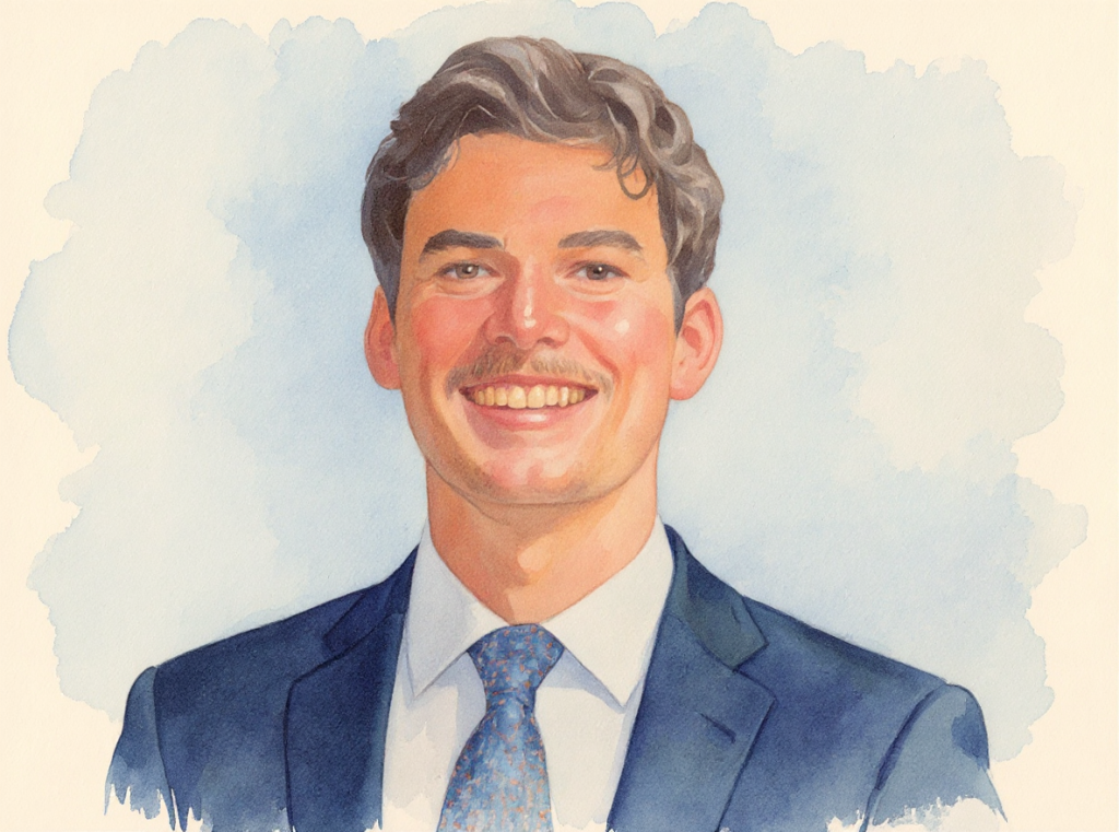
Jon Cliburn is a native of Baton Rouge, Louisiana. He graduated from McKinley Sr. High School before attending LSU and receiving a B.Sc. in Geography, with a minor in GIS. After graduation, he worked for the City of Baton Rouge in the Department of Traffic Engineering.
He joined C4G and has participated in several projects, including the 2018 & 2023 International Comparisons of Absolute Gravimeters at Table Mountain in Colorado, as well as the 2024 AstroGeodetic survey of the Baton Rouge/New Orleans corridor, in cooperation with NOAA/NGS. He is an avid fan of baseball and bluegrass music.
2024 Astrogeodetic Survey of the route between Baton Rouge and New Orleans in cooperation with NOAA/NGS and others
2018 & 2023 International Comparison of Absolute Gravimeters (ICAG) at NOAA's Table Mountain Gravity Observatory near Boulder, Colorado
2015 – 2017 City of Baton Rouge Traffic Engineering
2015 B.Sc. in Geography, Mapping Sciences, LSU
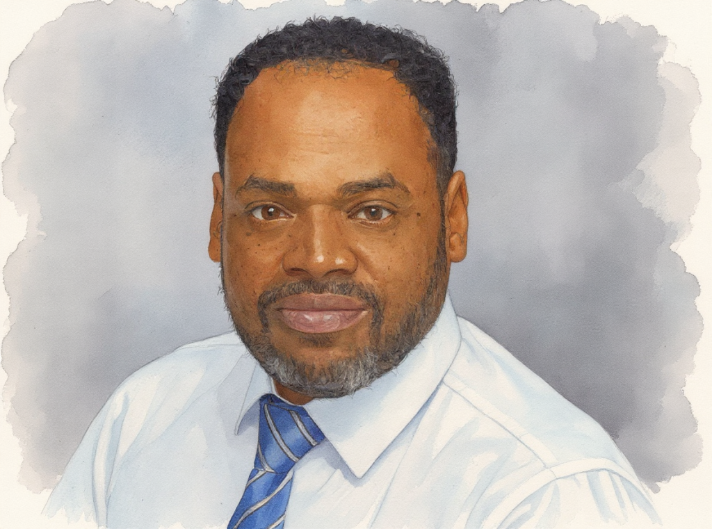
Roy K. Dokka, Ph.D. – Founder, Executive Director (deceased)
Roy Dokka was the Founding Executive Director, Center for GeoInformatics and Louisiana Spatial Reference Center, Fruehan Endowed Professor of Engineering
Professor Dokka joined the Department of Geology & Geophysics at LSU in 1980 as an assistant professor, having received his Ph.D. in Geological Sciences from the University of Southern California. He was promoted to Full Professor in 1990 and became the first recipient of the Adolphe G. Gueymard Professorship in Geology & Geophysics in 1998.
In 2001, he became the Center for GeoInformatics' first executive director. Dr. Dokka joined the Department of Civil & Environmental Engineering and helped build new research and academic programs in Geodesy and Geoinformatics. In 2002, he initiated the Louisiana Spatial Reference Center in partnership with NOAA's National Geodetic Survey, focusing on creating a state-of-the-art positional infrastructure for Louisiana. In 2003, he was selected as the Fruehan Endowed Professor of Engineering. He had the unique distinction of being the only professor in LSU history to have been honored with endowed professorships from two different colleges (Basic Sciences and Engineering).
His research interests centered on the application of the Global Positioning System (GPS) and geodetic leveling to study the geologic subsidence affecting Louisiana’s coast and mid-continent, as well as understanding the roles that tectonism and climate play in shaping landscapes. Dr. Dokka was a Fellow of the Geological Society of America and was awarded a lifetime honorary membership in Alpha Lambda Delta, the National Freshman Honor Society, for his record of outstanding teaching. Dr. Dokka received ten University, College, and Departmental teaching awards. This includes the 1990 LSU Alumni Association Distinguished Faculty Award. He received a Presidential Citation in 2003 for “outstanding service to the surveying profession in Louisiana” from the Louisiana Society of Professional Surveyors. He is the author of over 55 publications in refereed professional journals. He proudly served as the major professor for 23 outstanding men and women who completed their master's and doctoral degrees at LSU.
In 1992–1993, Dr. Dokka served as a Program Director at the National Science Foundation. He was a member of several national policy committees for NSF and NASA, focusing on Geology, Geographical Information Systems, and Geodesy. He was also the Past19President of the South-Central Section of the Geological Society of America.
The CORS Height Modernization Survey Station, “DOKKA,” in Gibson, Louisiana, has been established to honor Dr. Dokka's contributions to C4G as a lasting recognition of his legacy. Additionally, the CORS Active Control Monument, “1ROY” in Oak Grove, Louisiana, has been established to honor Dr. Dokka's contributions to C4G as a lasting tribute to his legacy.
Joshua D. Kent, Ph.D. – GIS Manager and Geodetic Researcher (deceased)
Joshua David Kent was born in New Orleans in 1970. Josh graduated from De La Salle High School in New Orleans and received his Bachelor of Science degree from Louisiana State University, where he also earned his Master's degree and later attained his Doctorate in Geography.
He was the GIS Manager and research lead for the C4G at the time of his death in 2017. His research focused on geographic information sciences and technologies, including the multi-scale spatial and temporal analysis of dynamic phenomena.
He published extensively, with his research focusing on the long-term impacts of subsidence and global climate change on emergency evacuation routes in coastal Louisiana. He also researched the location and effects of oil infiltration in our coastal marshes and bays, Web-based mapping, “big-data” analysis and management, geospatial data visualization, cartographic methods, and geodesign strategies. He was the lead consultant in scanning and initial cataloging of the entire State Land Office Records and Plats.
Dr. Kent was a respected academic, particularly known for his contributions to literary and cultural studies. He served as an Assistant Professor at Louisiana State University (LSU). There, he made significant contributions in various research areas, including postcolonial literature, identity studies, and the cultural implications of literature. His research explored interactions between literature and societal transformations, contributing to a deeper understanding of cultural narratives.
He initiated Relative Gravity surveys in metro Baton Rouge & the LSU campus, and developed novel observation techniques using state-of-the-art CG-5 relative gravity meters. He also authored multiple essays and academic papers, one notable collection being titled "Essays on the Integration of Anisotropic Landscapes Within Contemporary Geographic Profiling Models." This work reflects his broad interest in how various disciplines intersect with literature.
The CORS Active Control Monument, “KENT” in Kentwood, Louisiana, has been established to honor the contributions of Dr. Kent at C4G as a lasting recognition of his legacy.
Relationship to National Spatial Reference Frame
In August 2001, NOAA informed Congress that Louisiana’s vertical geodetic control was obsolete and unsafe due to land movement, sea-level rise and historic survey errors. To address these issues, the LSU Center for GeoInformatics (C4G) partnered with the National Geodetic Survey (NGS) in 2002 to establish the Louisiana Spatial Reference System (LSRS). For over two decades, the Louisiana Spatial Reference Center (LSRC) has served as a trusted authority, supporting public and private entities across the state.
The C4Gnet Real-Time Network delivers significant cost savings to the private sector, underscoring LSRC’s critical role in an increasingly location-dependent society. LSRC’s long-standing collaboration with NGS, the nation’s geodetic control authority, further demonstrates its value. Legislative Act 626 of 2024 designates LSRC’s GULFnet CORS network as Louisiana’s official geodetic reference, which includes more stations than the NGS CORS network in the state. LSRC remains committed to maintaining GULFnet’s alignment with the National Spatial Reference System in support of NOAA and NGS missions.
Outreach
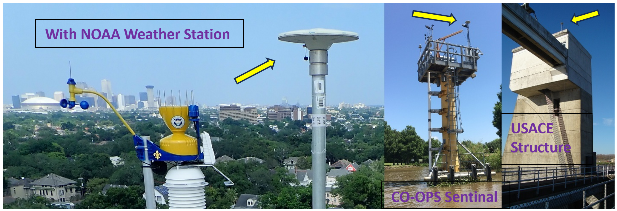
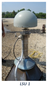 Our efforts began in the 1990s, as we assisted and collaborated with the mapping, surveying, engineering, and academic communities by establishing Station LSU 1, a precursor to CORS, known as a Cooperative Base Network Control Station. Today, that location is an NGS CORS named 1LSU. In the early 2000s, GULFnet was born. Data is now available from the C4G Reference Data repository or the NGS CORS webpage, or by subscription for kinematic purposes.
We conduct outreach through personal communications, workshops, presentations at association and industrial meetings venues, virtual meetings, and by offering products and services on our website. One such effort is our collaboration with the Louisiana Society of Professional Surveyors (LSPS) to inform the principal users of the modernized GNSS capabilities. Another event is Introduction to the National Spatial Reference System (NSRS), the new North American Terrestrial Reference Frame (NATRF2022), the North American-Pacific Geopotential Datum of 2022 (NAPGD2022) and the Louisiana Plane Coordinate System (see Act 626 of 2024).
The C4G/LSRC fosters cooperation and partnerships within several affiliated agencies. The C4Gnet’s nearly 1,500 registered users comprise federal, state, local agencies, private companies, and academic researchers, many of whom have multiple accounts. Outreach capabilities have been enhanced through cooperation with professional and governmental agencies, facilitated by coordinated events and activities.
Innovation
The LSRC's role is critical in maintaining a spatial reference system for Louisiana and the Gulf Coast, as well as providing support to education and outreach through the surveying, engineering, and educational communities. Our database and website play a crucial role in advancing science and supporting industry. We continue to innovate in Geodesy and Geophysics, delivering reliable, accurate real-time data to our users. For over a quarter of a century, our contributions have proven their worth.
We must continue and IMPROVE upon our successes and continue to INNOVATE, to serve the growing importance of geospatial data to modern society by providing and enhancing the recognition of that value:
We enhance the programs our users rely on by investing in technology that expands our spatial expertise for science and industry, and by increasing awareness and use of our services, which help address various political, social, and scientific problems.
Support
Perhaps our most significant challenge is to maintain a current and precise spatial reference system. This relies on our ability to relate the North American tectonic plate to our state and the Gulf region in relation to the NSRS and the global reference frame, where large areas of subsidence challenge the Gulf states’ infrastructure and society’s environment.
The LSRC is unique in its practical solutions to this challenge, as the rapidly evolving technology has advanced in computing, instrumentation, communications, and infrastructure. A notable example is the publication of accurate control data for the area, which is then disseminated through the C4G website and Real-Time subscription applications. We continue to serve as an authority for legislative inquiries and provide guidance on geodetic control. We must maintain these roles as testimonials to the value of our services to the Surveying, Engineering, and broader communities, as addressed throughout this document and in the 'What Others Say' section.
Since the 2001 NGS/NOAA Report to Congress, in collaboration with our academic and professional associations, we continue to innovate in the geodetic and geophysical sciences. Recently, LSRC collaborated with Federal and international partners to conduct a valuable astrogeodetic study along the Mississippi River, between Baton Rouge and New Orleans, to validate the new geoid model. Our efforts become even more critical with the anticipated release of the 2022 NSRS Datums by NGS. Louisiana's Gulf Coast presents unique and inconsistent subsidence rates and causes, loss of coastline, and maintenance of vertical control.
However, we must find the resources necessary to maintain this service and to continue the transition to the new 2022 datum. The LSRC/C4G is uniquely positioned to accomplish this. We must leverage the value of our expertise through ongoing collaboration with science, government, academia, and industry, while continually maintaining and developing solutions for our users.
The GULFnet is mature and has a significant user base. Today, users view C4Gnet as a vital component of GULFnet based on its proven dependability. However, our program lacks financial self-sufficiency to sustain necessary growth. We must maintain our ability to provide real-time GNSS base-station data to users, even as new, more precise, or efficient means become available.
Dependable geodetic control is necessary for coordinated emergency response programs. We must continue to maintain geodetic infrastructure following hurricanes, floods, and other catastrophic events, and provide the resources needed for emergency response. To ensure this level of readiness, engagement with state partners and educators is essential.
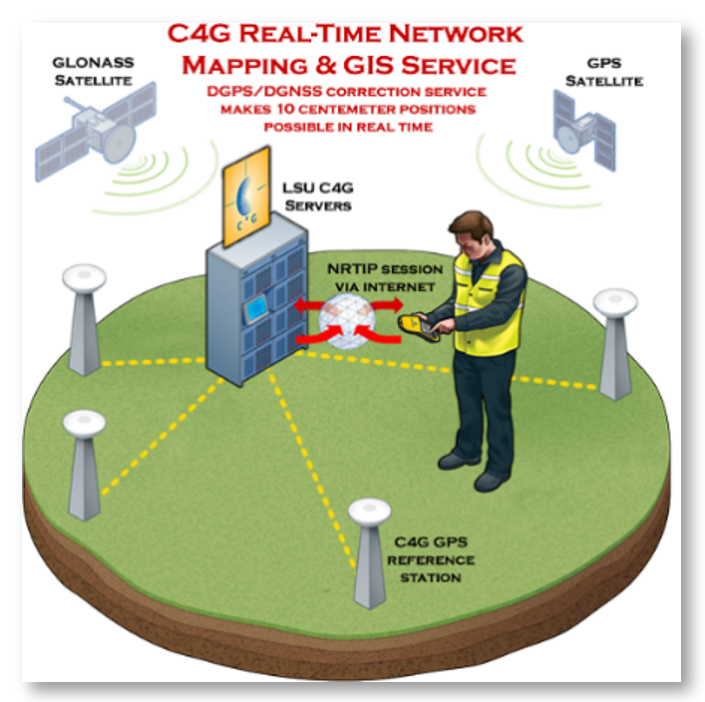
With C4Gnet, subscribing is easy, and the range of flexible plans is suitable for various applications. The RTN is ideal for most applications. End-user cell modems communicate with the server to receive RTK-type corrections. They provide golf ball-size accuracy with fast initialization times after connection.
Support includes:
- Education and outreach (seminars, presentations, webinars, social media);
- Coordination of Coordinating Council activities (semiannual meetings);
- GULFnet & C4Gnet stakeholder engagement (e.g., state and local agencies, utility districts, private sector, academia);
- Geodetic and geophysical science efforts, particularly subsidence monitoring;
- Publication and maintenance of GULFnet coordinates tied to the NSRS;
Modernize
 The LSRC is uniquely positioned to provide a common, standard reference frame for Reality Capture by maintaining the LSRS, which is crucial in today’s geospatial services. This concept relies on digitizing positioning and remote sensing into three-dimensional, high-resolution models. These models can be cataloged in a dated system for historical and forecasting purposes in the management of infrastructure and resources.
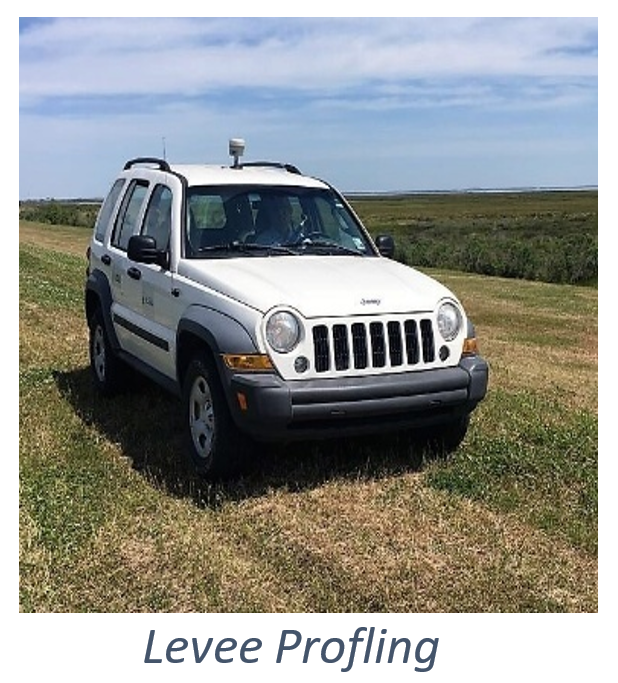
Natural resources, infrastructure, subsidence, and deformation monitoring require precise long-term and real-time geospatial observations. Continuously operating sensors, such as those enabled by C4Gnet and GULFnet, provide temporal consistency for Reality Capture models. Examples include profiling hurricane protection levees post-Katrina for the Louisiana Legislature, monitoring subsidence around sinkholes for the La DOTD to anticipate potential highway damage, and providing control points for InSAR observations by the Scripps Institution of Oceanography.
In today’s world, education is often disseminated through social media feeds. The C4G/LSRC must utilize such practices for education and outreach. Training programs for user applications, along with guidance on connecting and using our resources, are valuable offerings to existing and potential users. Regular updates are posted to online platforms, educating and attracting today’s professionals. Social media requires providing meaningful, up-to-date content. The C4G/LSRC embraces that commitment.
Modernization:
-
- Update the dynamic geodetic reference frame and continue building capacity.
- Integrate various technologies such as hydrology, geology, gravimetry, astronomy, InSAR and NISAR with GNSS.
- Maintain our web interface and improve accessibility, content, &c.
- Provide education about the geodetic framework and be ready to support rapid rebuilding following a disaster to federal, state, and local agencies; the private sector; and academia.
- Maintain strong links to the geospatial community and the public through education and outreach.
- Share expertise and disseminate geodetic topics and technology disrupters via social media.
Expand
The LSRC, with our geospatial expertise and intimate collaboration with several leading marine and Earth sciences groups, can partner with ongoing research. We seek organizations with which to collaborate on pursuing research grants. The value of Louisiana’s coastal resources is second to none. As is well known, subsidence poses a serious risk that demands serious study for the design and protection of our invaluable coastal resources, as well as for improved understanding of the geophysical and anthropogenic processes. The LSRC provides a reliable reference frame that is rigorously tied to the NSRS and, therefore, the ITRF. The LSRC and its geodetic foundation unify disparate studies and networks.
Current C4G/LSRC users include Surveyors, Engineers, planners, researchers and developers of precision navigation and research projects. Efforts to better understand the needs of these groups guide our future improvements and help us build new partnerships. The C4G/LSRC provides a consistent reference frame to meet current and future requirements. Creating partnerships to provide data streams or real-time meteorological information for tracking weather is a worthy option we are exploring.
Expansion Potential:
- To facilitate modernization, pursue new funding opportunities and collaborations, from the Federal. State, Local agencies and the private sector.
- Lobby state, parish, and federal partners for agreements to improve the geodetic framework and remain robust during disasters.
- Engage users and promote activities to expand subscriptions.
- Promote the development to expand data streams such as weather, tidal, and others.
- Ensure ‘QA/QC’ of geodetic networks.
- Expand support for precision navigation, both land and waterborne.
- Support graduate programs in Geodesy.
Financial Strategy
As we plan for the future, we look forward to ensuring that our goals and responsibilities are being met and that we are financially secure. The basic costs for maintaining current C4G/LSRC operations are nearly $1,000,000, assuming we only keep the current status quo.
However, the C4G/LSRC must seek an overall operating budget that reflects our priorities and offerings within a structure of continued support, modernization and expansion as outlined in this document. Our strategic vision must consider new investments in resources and technology. For example, human, computational, physical, programming, cloud computing, security, telemetry and social media. A funding level of $2.5 million per year will adequately support the goals outlined in this document. This level of funding is justified in exchange for the unique, valuable services we plan to provide.
We have witnessed and incorporated significant changes in resources and technology since 2001, incorporating relevant scientific and technical advances. The LSRC is poised to continue this trend by forming new partnerships, expanding its user base, and further enhancing its expertise. Until now, the LSRC has benefited from several research activities funded by the NSF, NOAA/NGS, the LSU Board of Regents, and others, as well as the explicit support of C4Gnet subscribers.XYZ. The LSRC must find ways to generate continuous, long-term, independent funding sources.
By serving our stated mission of maintaining the NSRS in Louisiana, the LSRC is unique, providing a public utility that spans federal, state, local, and private sectors and can operate more effectively than any other entity. We must expand our pool of resources to ensure the continued health and financial health of the LSRC. Our mission is public, as evidenced by our affiliation with Louisiana State University, the state's flagship institution, which is firmly committed to research, education, outreach, and entrepreneurship. Our successful management and maintenance of GULFnet and C4Gnet must be advertised and leveraged to secure additional financial resources.
We welcome comments on the LSRC’s priorities and guidance on how to sustain the LSRC. The future of LSRC and C4G depends on feedback and contributions from many quarters, including local and state organizations, academia, and the public and private sectors, who rely on our expertise and dedication to the success of the C4G/LSRC mission.
Conclusions
Through the LSRC’s maintenance of GULFnet, we have long been recognized as the guardian of Louisiana’s geodetic control. Our role is particularly significant given the unique complications arising from the state's active geologic setting and extensive areas of subsidence.
Through the C4G’s maintenance of C4Gnet RTN, we have provided real-time surveying, mapping, and navigation services to subscribers, including surveyors, researchers, or farmers, throughout the state since 2007. It is their loyalty to the system that essentially validates its existence, supports its robustness and growth, and supports the research efforts of LSRC.
We must redouble our efforts to promote the value of our services and to increase funding. We must continue to develop value-added products through our projects and services, such as C4Gnet and the GULFnet reference frameworks. Our partnerships with users, manufacturers, educators and distributors are essential to realizing our full potential.
The LSRC and C4G will continue to expand our efforts, including outreach, research, collaborations, interactions, and public presentations. Critically, the LSRC and C4G must remain at the forefront of this growth in supporting Louisiana.
We will remain enthusiastic partners of Louisiana State University and sister academic institutions as part of their public mandate for research and education. We promote the development of a professional Master’s program in Geodesy.
We are incredibly proud and intend to continue our legacy of serving the people of Louisiana and its communities. We are fully committed to providing reliable, freely available geodetic control and look forward to continuing to serve as a public resource, benefiting society as its reliance on precise information grows.
The LSRC & C4G are vibrant, living entities that review and update priorities, technologies, and associated changes.

What Others Say:
Congratulations to you and to everyone at the Center for GeoInformatics at LSU on 25 years of service. This milestone marks a quarter-century of work that has become vital to the State, the region, and the nation.
Reflecting on our partnership with the C4G organization from the start, the establishment of the real-time network of GPS CORS stations arrived at a critical moment. It addressed the realization that thousands of static reference benchmarks were seriously out of date, no longer accurate, and could not be relied upon for any purpose.
As we look at billions of dollars in coastal restoration, infrastructure projects, the study of relative sea level rise, and major flood protection efforts, the C4G network and resources have proven essential. Your work is critical for evaluating the vulnerability of landscapes and communities to storm surge and tidal inundation, and it remains a cornerstone for daily work and future planning in sustaining coastal infrastructure across the Gulf.
I hope each of you understands how important your work has been and continues to be. Twenty-five years ago, few could have fully realized that local flood protection authorities, federal, state, and local governments, ports, and LNG facilities could all obtain highly accurate elevation and position data in real time with a simple subscription to C4G. Today, you can see surveying teams, construction projects, and coastal restoration efforts everywhere, all employing equipment linked to the C4G Real Time Network (RTN).
Thank you to everyone currently on the C4G team, and to those no longer with us who helped build this great organization and are remembered every day.
C4G was the catalyst for a major advancement in geodetic control and surveying quality in Louisiana. Under Dr. Roy Dokka’s leadership, the dedicated C4G and LSRC team enabled reliable connection to the National Spatial Reference System at a time when subsidence severely complicated vertical control and the limitations of the existing benchmark network were an ongoing source of concern. GULFnet delivered the stability required, supported by LSRC and C4G’s use of gravimetry to refine the geoid model. I personally validated much of the sparse benchmark control that existed when GULFnet first went live, and the results were remarkable.
From rivers, wetlands, deltas to continental shelves, the Louisiana Spatial Reference Center provides critical and valuable data for hydrological, physical, and geological surveys and observations. LSU coastal and environmental research have been very much dependent on the C4Gnet for many years.
It’s a no-brainer! You get the increased efficiencies and confidence for a fraction of the cost of even an entry-level field hand. It doesn’t take much business sense to figure that one out.
Last week I was in Lake Charles down to Cameron, this week I've been from Belle Chase to New Orleans and today in north of Baton Rouge. This system has worked flawlessly. Yesterday was a 13,000 point topo on a levee and today I'm shooting single geo borings, this would have been a 4-5 day job the old RTK way.
The customer service that you provided was excellent. You provided all of the necessary connection data in a timely manner. When my survey crew arrived on our site in New Orleans they were able to connect without any problems. I had them check into two NGS monuments and the accuracy results were within our tolerance. I have to say our experience using your network was excellent and I would definitely recommend it to other surveyors.
Useful Links
LSU Website - Primary entry point for university-wide information, academics, research, and contacts.
-
- Louisiana State University (LSU) | Official homepage
https://lsu.edu/
- Louisiana State University (LSU) | Official homepage
Center for GeoInformatics (C4G) Overview - Geodesy, geospatial research, and services including Louisiana's statewide GNSS real-time network.)
-
- What is C4G? | LSU Center for GeoInformatics
https://c4g.lsu.edu/what-is-c4g/
- What is C4G? | LSU Center for GeoInformatics
Louisiana Spatial Reference Center (LSRC) - Serves as the state's designated center for spatial reference systems and CORS coordination under the National Geodetic Survey.
-
- What is LSRC? | Louisiana Spatial Reference Center
https://c4g.lsu.edu/what-is-lsrc/
- What is LSRC? | Louisiana Spatial Reference Center
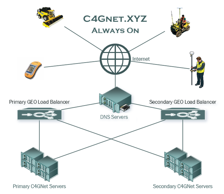
GULFnet / C4Gnet Real-Time Network - Real-time GNSS stations across Louisiana.
-
- GULFnet | Interactive sensor map of the statewide network of Continuously Operating Reference Stations
https://c4gnet.xyz/Map/SensorMap.aspx (View real-time GNSS stations across Louisiana.) - C4Gnet.XYZ? | LSU subscriber-funded C4G Real-Time Network (RTN) information
https://c4g.lsu.edu/what-is-c4gnet-xyz/ (Details on Louisiana's statewide GPS/GNSS Real-Time Network operated by C4G.)
- GULFnet | Interactive sensor map of the statewide network of Continuously Operating Reference Stations
C4G Frequently Asked Questions - Central FAQ. Covers questions on the Real-Time Network (RTN/C4Gnet.XYZ), Continuously Operating Reference Stations (CORS/GULFnet), Surveying best practices (e.g., control narratives, RTN usage in projects), and LSRC-related topics like spatial reference systems and state plane coordinates.
-
- https://c4g.lsu.edu/all-faqs/All FAQs | LSU Center for GeoInformatics – RTN, CORS, Survey, LSRC
- RTN FAQs → https://c4g.lsu.edu/all-faqs/rtn-faqs (Real-time corrections, mountpoints, multi-GNSS support, network alignment, etc.)
- CORS FAQs → https://c4g.lsu.edu/all-faqs/cors-faqs/ Details on data access (including free public raw data from many sites via C4G or NGS), NOAA CORS Network integration, etc.
- Survey FAQs → https://c4g.lsu.edu/all-faqs/survey-faqs/ Guidance for surveyors using RTN/CORS in Louisiana projects.
- LSRC FAQs → https://c4g.lsu.edu/all-faqs/lsrc-faqs/ State-specific reference system questions, vertical/horizontal datums, etc.
Recent Legislation: Act 626 of 2024
-
- Act 626 of 2024 | Updates to the Louisiana Plane Coordinate System (full act text)
https://legis.la.gov/legis/ViewDocument.aspx?d=1382355
(Enacted in 2024 Regular Session; modernizes surveying/mapping standards by establishing the official Louisiana Plane Coordinate System based on the latest National Spatial Reference System (including NATRF2022 datum). It defines North, South, and Statewide zones, deprecates older systems like the 1927/1983 versions, and references coordination with the LSRC/C4G for CORS restoration in emergency planning. Effective August 1, 2024.)
- Act 626 of 2024 | Updates to the Louisiana Plane Coordinate System (full act text)
Sample Publications:
Surveying & Geodesy
Albayrak, M., Hardy, R., Fernández, B., Cliburn, J., & al. (2025). Assessing the performance of GEOID2022 along the Mississippi River in Southern Louisiana.
Albayrak, M., Hardy, R., Fernández, B., Cliburn, J., Baeriswyl,A. P., Willi, D., Guillaume, S. (2024). Colocated Observations of Deflections of the Vertical along the Mississippi River Using Four Astrogeodetic Systems: CODIAC, VESTA, QDaedalus and TSACS., AGU 2024 Conference, Washington, D.C., DOI: 10.13140/RG.2.2.17546.73922
Mugnier, C. J. (2021). Innovative geodetic tools for disaster recovery in coastal regions. Geospatial Journal, 16(4), 521-532. doi:10.1007/s41440-021-00312-0.
Mugnier, C. J. (2018). Grids and Datums of the World. Boca Raton, FL: CRC Press.
Mugnier, C. J. (2018). Geospatial Information and the Role of Technology in Modern Geodesy. New York, NY: CRC Press.
Mugnier, C. J. (2018). The application of GPS to assess coastal land loss. Journal of Coastal Research, 34(6), 1353-1367. doi:10.2112/JCOASTRES-D-16-00234.1.
Abdella, A. (2015). Assessment of urban land use change using remote sensing and GIS. Journal of Urban Planning and Development, 141(3)
Cavell, J. A., Kent, J. D., Mugnier, C. J., & Dunaway, L. E. (2015). DOTD standards for GPS data collection accuracy: Final report.
Mugnier, C. J. (2015). The role of geodesy in environmental monitoring. EOS Transactions, American Geophysical Union, 96(31), 273-274. doi:10.1029/2015EO031490.
Mugnier, C. J. (2014). Geodesy: A Comprehensive Approach. Boca Raton, FL: CRC Press.
Kent, J. D., Garman, K. A., Le, T., & De La Garza, J. (2012). Geodetic control for GPS and geospatial applications in Louisiana. Louisiana State University.
Mugnier, C. J. (2010). GPS for Geodesy: The Advanced Approach. Boca Raton, FL: CRC Press.
Cavell, J. A., Dokka, R. K., & Mugnier, C. J., (2009). Reference measurements of pavement management system roadway elevations: Tech summary. Louisiana State University, Louisiana Transportation Research Center.
Shinkle, K. D., & Dokka, R. K. (2004). Rates of vertical displacement at benchmarks in the lower Mississippi Valley and the northern Gulf Coast. National Geodetic Survey.
Cavell, J. A. (1995). GPS Project Manager’s Report to the Ministry of Communications, Kingdom of Saudi Arabia: Advice and Application for GPS in the Kingdom. Including a Rectified Skewed Orthomorphic Plane Projection for the Kingdom.
Geology & Materials
Voyiadjis, G. Z., Zhou, Y., & Abdalla, A., (2024). Creep-induced subsidence along coastal Louisiana with GPS measurements and finite element modeling. Journal of Geoenergy Science and Engineering, 2024, Vol. 238, 212840.
Varugu, B. K., Jones, C. E., Wang, K., Chen, J., Osborne, R. L., & Voyiadjis, G. Z. (2024). Optimized GNSS cal/val site selection for expanding InSAR viability in areas with low phase coherence: A case study for southern Louisiana. IEEE Journal of Selected Topics in Applied Earth Observations and Remote Sensing, 17, 4875-4889. doi:10.1109/JSTARS.2024.3361800.
McMillan, J. R., Fernández, B., Kent, J. T., & Stewart, S. E. (2022). Full-Scale Testing of Geosynthetic-Reinforced, Soil-Integrated Bridge System. Journal of Bridge Engineering, Vol. 27, No. 3.
Fernández, B., Kent, J. T., & McMillan, J. R. (2021). Field Investigation of Pile Setup in Mixed Soil. Journal of Geotechnical and Geoenvironmental Engineering, Vol. 147, No. 2.
Fernández, B., Kent, J. T., McMillan, J. R., & Stewart, S. E. (2021). Performance Monitoring of Geosynthetic Reinforced Soil Integrated Bridge System (GRS-IBS), Louisiana. Journal of Bridge Engineering, Vol. XX, No. XX.
Voyiadjis, G. Z., and Zhou, Y., (2018). Time-dependent Modeling of Subsidence due to Drainage in Bounding Shales: Application to a Depleted Gas Field in Louisiana, Journal of Petroleum Science and Engineering, 2018, Vol. 166, pp. 175-187. DOI: 10.1016/j.petrol.2018.03.032
Zhou, Y., & Voyiadjis, G. Z. (2019). Finite element modeling of production-induced compaction and subsidence in a reservoir along coastal Louisiana. Journal of Coastal Research, 35(3), 600–614. doi:10.2112/JCOASTRES-D-18-00020.1.
Kent, J. D., Mugnier, C. J., Osborne, R. L., Dunaway, L. E., & Cavell, J. A. (2015). Southern Louisiana Subsidence Vulnerability Estimates. Esri Map Book, Volume 30, pp. 57. ESRI Press.
Dokka, R. K., & Kent, J. D. (2012). Potential impacts of long-term subsidence on the wetlands and evacuation routes in coastal Louisiana. GeoJournal, 77(4), 547-561. doi:10.1007/s10708-011-9417-4.
Dokka, R. K., & Dixon, T. H. (2008). Earth scientists and public policy: Have we failed New Orleans? Eos Transactions American Geophysical Union, 89(7), 57-58. doi:10.1029/2008EO070001.
Environmant & Weather
Abdella, A., (2020). Evaluating the effects of urbanization on local climate: A case study. Environmental Science and Policy, 112, 109-120.
Abdella, A., (2019). Advanced geospatial techniques for flood risk assessment. Journal of Environmental Management, 230, 174-185.
Abdella, A., & al. (2017). Impact of climate change on water resources in arid regions. Water Resources Management, 31(6)
![]()