
 |
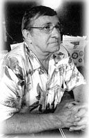
The former NGS advisor to the State of Louisiana, Bob Zurfluh, passed away on Saturday, November 14, 2009, at the age of 66. Mr. Robert LaVern “Bob” Zurfluh was born June 25, 1943 in Haddam, Kansas. Bob was a federal surveyor for the United States Coast and Geodetic Survey for 40 years and also served his country in the United States Army in Vietnam. Mr Zurfluh was a life member of the VFW Post 5620. The family requests that donations be made to VFW Post 5620 in Carthage, Texas or the charity of your choice. |
NOAA, National Geodetic Survey
HEIGHT MODERNIZATION COORDINATION MEETING
AGENDA
SSMC3, Room 8836
Date: Thursday, September 13, 2012
Time: 2:00-3:30 pm East Coast time
Call In: 877-988-6989, PASSCODE: 1680881
Webinar: https://www2.gotomeeting.com/register/603779386
Purpose: To exchange information and provide an update on National Height Modernization activities, events, and issues; to enable better collaboration with our partners and within NOAA to accomplish Height Modernization objectives; to improve NGS’ Products and Services for our constituents.
NOTE: Because interest in the feature topic is expected to be high, the general meeting has been shortened to 5-10 minutes then the topic presentation will begin.
- Updates from States – e.g. projects, outreach
- Monthly presentation
Presentation, to start at approximately 2:10 PM:
GEOID12A
Dan Roman, National Geodetic Survey
NGS has recently released updated models for transforming ellipsoidal coordinates and orthometric (e.g. NAVD 88) heights. After detecting significant defects in the control data used to create GEOID12, GEOID12A was developed as a replacement. This presentation will discuss the development of changes in the most recent geoid models.
Daniel R. Roman, Ph.D. (
- Other Business
Important Links: Previous months’ meeting notes and a list of future meeting presentations can be found at: http://www.ngs.noaa.gov/heightmod/MeetingNotes.shtml
The Center for GeoInformatics proposed the CORS station at Loyola University (New Orleans) for inclusion into the National CORS network. This will bring greater integration and ease of access for Louisiana users, including OPUS and archival services available through the NGS portal.
The Loyola CORS station was installed October 18th, 2005 by C4G staffers Tony Cavell and Richard Capone. The station, tentatively named LOYL, has been providing 1sec epoch data since installation.
The NGS OPUS tool is now using GEOID12 for improved NAVD 88 orthometric heights!
![]() Current frame solutions are consistent with newly-adjusted NGS datasheets.
Current frame solutions are consistent with newly-adjusted NGS datasheets. ![]() Prior frame access will expire on 15 July, 2012.
Prior frame access will expire on 15 July, 2012.
The GULFNet Real Time Network runs a constrained adjustment to the prior NGS reference frame which is NAD 83 (CORS96) Position (Epoch 2002.0) and is the basis for the NAD 83(2007) adjustment. This reference frame will become obsolete on July 15th, 2012. Due to this, C4G will be taking GULFNet RTN offline on July 16th and reconfiguring the equipment to become backup servers for the C4Gnet RTN running on a constrained adjustment to the current NGS reference frame.
All C4G Real Time Network clients should be switching over to the C4Gnet RTN if they are currently using the GULFNet RTN as this system will not be available after July 15th, 2012.
C4Gnet RTN data are based on the new reference NGS CORS coordinates in IGS08 epoch 2005.00 and NAD 83(2011) Position (Epoch 2010.00) adjustment.